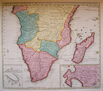
South of Africa and Madagascar, Jaillot, 1792
£1,200.00
SKU: MAAF0050
Category: Africa
585 mm by 509 mm
- Description
Description
Description
Carte de L’Afrique Méridionale ou Pays Entre La Ligne & Le Cap De Bonne Esperance Et Isle De Madagascar.
Map of the South of Africa with magnified view of Madagascar
Hand coloured antique coper engraving of Africa including Gambon, Rep. of the Congo, Democratic Republic of the Congo, Tanzania, Angola, Zambia, Zimbabwe, Mozambique, Namibia, Malawi, Botswana, South Africa and Madagascar.
Showing details including an elevation and plan of the port and Mount Table at the Cape of Good Hope in South Africa and a magnified view of Madagascar.
Printed in Amsterdam in 1792 by Ian Barend Elwe. It is a reissue of a 1694 map by French geographer Alexis Hubert Jaillot, who was first to be created Geographe du Roi (Louis XIV).
Related Products
