0 ITEMSView basket
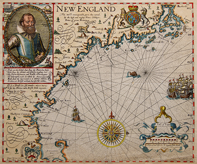
USA, New England, Nautical Chart, Captain John Smith, c1900
£420.00
SKU: MAAM0141
Category: North America
350 x 290 mm
- Description
Description
Description
New England by Captain John Smith first printed in 1614.
An antique facsimile map reprinted by George Low of London c1900.
An important map, the first to name New England, by one of the earliest British explorers, Soldiers and Governors or the region and famous for his relationship with Pocahontas.
Published c1900.
Related Products
