0 ITEMSView basket
- Description
Description
Description
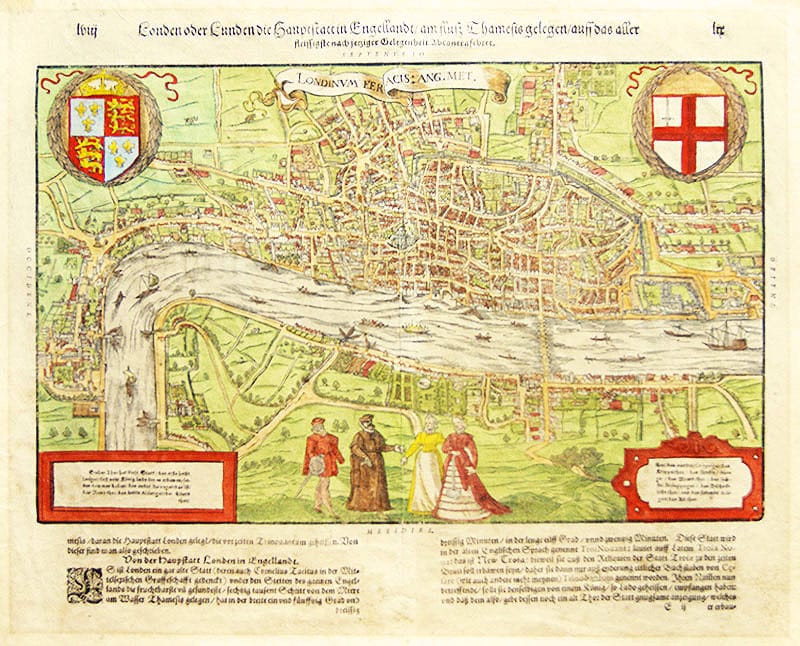
Original antique woodblock printed map, date 1598.
This map illustrates the Elizabethan city of London showing the area between Clerkenwell, Wapping, Southwark and Westminster Abbey. Two magnificent coats of arms, two columns of text within map referring to the City gates ( and two columns of text below map). Several vessels in the Thames. Two gentlemen with their elegantly dressed ladies in the foreground. Good full color example of this highly sought after plan of London.
Related Products

